Maps are a powerful way to visualize location-based data and make your designs more engaging. In Venngage, you can insert maps into your designs, customize their style, and make them accessible with alt text.
Map Access
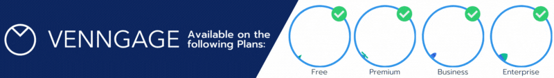
Free users have access to maps of United States and Canada.
Premium+ users have access to the full catalog of map charts.
You can add maps to your canvas, change their type, and describe them with alt text for accessibility.
Add a Map to the Canvas
In the left sidebar, click Charts, then select Maps.
Scroll through the thumbnails or use the search bar to find the map you want.
Click on the map to add it to your canvas.
-
Resize or reposition the map by dragging its bounding box or moving it on the canvas.
Customize Your Map
By default, maps are set to the Choropleth type. You can adjust the style in the Edit Chart panel:
-
Choropleth → color-coded by data values.
-
Bubble → display data with bubbles sized by value.
-
Monochrome → simple, single-color map.
You can also use the panel to edit colors, labels, and other visual settings.
Editing Map Data
Under the Data tab, enter values directly into the cells or copy-paste from an external spreadsheet (CSV or XLSX).
Changes save automatically when you select another cell or press Enter/Return.
On a Choropleth map, regions change color based on minimum and maximum values.
On a Bubble map, circle sizes adjust according to values.
For advanced customization, adjust the number of steps to create more or fewer color gradients for Choropleth maps.
Set minimum and maximum ranges, choose different color gradients, or assign custom colors for regions with no data.
Change border colors for the geographical areas.
Customize Labels and Legend
Toggle name and value labels on or off.
Customize label prefix/suffix, font face, size, style, and optionally add text outlines.
For Choropleth maps, adjust the Legend: turn it on/off, edit the title, and adjust font size, style, and face.
For Bubble and Monochrome maps, similar styling options are available under the Setup tab, including colors, labels, borders, and text outlines.
Add Alt Text to Your Map
Alt text makes your map accessible for people using assistive technology or with visual/cognitive impairments.
Click on the map to select it.
In the top toolbar, click Alt text (or press Tab + Spacebar).
Type a clear description of what the map shows, or click Auto-generate alt text to let Venngage create one for you.
Review (and edit, if needed) the description to ensure it’s accurate.
Click Save.
👉 Example: “Choropleth map of the United States showing population density by state. Darker colors represent higher density.”
👉 Learn more about which Map Chart works best to showcase your data.
Curious about upgrading? Compare our plan features side by side.